New suburbs are popping up all over the country as towns and cities continue to expand – but how they get their names appears to be somewhat of a mystery.
It’s that mystery and the blurred lines around where one suburb starts and where another finishes that could swing in favour of the homeowners, especially when it impacts the value of the house and the buyers they attract.
According to the NZ Geographic Board Ngā Pou Taunaha o Aotearoa – which is responsible for giving places including suburbs their official names, approving place names that are unofficial and changing place names – the councils generally propose a new name and boundaries, which they then process.
Read more:
Start your property search
- Auction record smashed: Buyers pay $12.8m for mansion they saw just 24 hours earlier
- Auction room erupts after 83 frantic bids on lifestyle home push price past $2m mark
- Highest ever asking price for Christchurch home: Fendalton mansion gets $9.75m price tag
But councils approached by OneRoof seemed to be less confident about their roles, with one saying their responsibility only went as far as naming streets not suburbs while another refused a resident’s OIA request for the suburb boundaries for the city on the grounds that there weren’t any official boundaries.
Recent history also shows that it’s often the brand given by a developer to market a new subdivision that at their request becomes the official suburb name rather than it being a local authority decision.
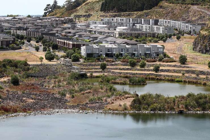
The former quarry on the edge of Mt Wellington and Meadowbank was branded Stonefields by the developer Landco Land Developments who also applied for it to become an official suburb in 2008.
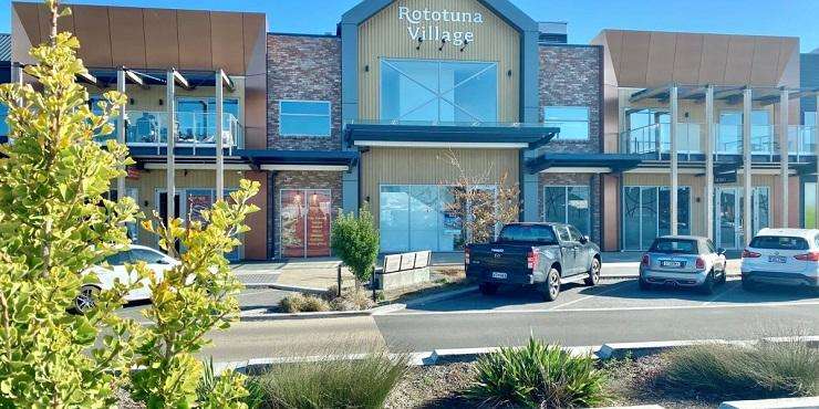
In the last few months Kirkdale Investments, the developer behind Rototuna Village in Hamilton North, recently decided to rebrand its subdivision as Kinfields. The announcement caused some confusion among residents and while for now it only refers to a specific development in the larger suburb of Rototuna, it is possible that in time the name could catch on. Once completed it is expected to house 20,000 residents.

The name given by the developer for Stonefields, in Auckland, stuck with the community and it became a suburb in its own right. Photo / Fiona Goodall

A commercial and residential development in north Hamilton has been renamed from Rototuna Village to Kinfields, which could eventually result in it becoming a suburb in its own right. Photo / Veros
Veros senior development manager Scott Bicknell, who worked on renaming the neighbourhood Kinfields with the owners, said in a statement about the rebrand that the neighbourhood needed its own identity given its size, masterplan design and unique destination.
QV operations manager James Wilson said it would probably come as a surprise to a lot of people that suburbs did not necessarily have a legal framework under which they operated and were often a market-derived concept.
“There are controls around them, but in terms of setting or acknowledging or having confirmed boundaries it’s not a local authority thing. It comes from a combination of various addressing locations which get kind of put together and have over time become known as a suburb.”
He said because the boundaries were sometimes blurred it was unsurprising there were inconsistencies in real estate listings with agents sometimes attaching certain streets to glamour suburbs which might attract more attention or higher values. For example, in Auckland, a property bordering Glen Innes might be referred to in the listing as St Heliers and in Christchurch, a street in Strowan might be advertised as its more prestigious Fendalton neighbour.

QV operations manager James Wilson said naming and deciding the boundaries for a suburb can be a grey area. Photo / Supplied
Harcourts salesperson Michelle Corkindale, who is based in Christchurch, said she can look up an address and find it under several different suburbs depending on what database she’s using.
“Sometimes it will all line up, but sometimes it won’t. For Somerfield, Beckenham, Sydenham – depending on where the cross-section is – you will get different answers.”
Corkindale took a “common sense approach” when deciding which suburb to attach to an address including looking at the school zones and whether it lined up with that suburb.
“I look at the school zones and then go ‘OK which of those suburbs will most likely head somebody towards it’. So, if you look at Cashmere High and you were looking at Sydenham and Somerfield and it was on the boundary you would put Somerfield rather than Sydenham because not all of Sydenham is in the Cashmere High zone but Somerfield is.”
However, she said it did have to be “within the realms of reality” and had seen examples of when some agents may have stretched a bit too far.
“You don’t want people coming along and being disappointed so you can’t be in Mairehau and put it’s Merivale – you could stretch some parts of it to St Albans, but you have to have that sensibility across it.”

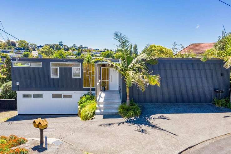
A family home at 5 Dover Place, in Remuera, is actually much closer to Meadowbank's amenities and zoned for Meadowbank School. Photo / Supplied
Barfoot & Thompson salesperson Rawdon Christie said navigating which suburb a street sat in could be a big issue, particularly in the areas he’s selling in such as Remuera, Meadowbank, Greenlane and One Tree Hill, where the lines could be blurred and there was often an expectation that some suburbs fetched higher values than others.
Christie said if they ever had any doubt or came across some discrepancies they always referred to the NZ Post classification for the suburb to make sure there was no false advertising.
A property he’s selling with colleague Steve Hood at 5 Dover Place was recognised by NZ Post as being in Remuera, but was much closer to Meadowbank with the local Meadowbank School just minutes away.
"It’s officially a Remuera address, but if you go down that street you are basically in Meadowbank because you are literally on that border." In order not to mislead buyers, the listing description then clearly points out its close proximity to Meadowbank train station and school.
But the most important thing for people wasn’t the suburb the property was officially in, he said, but what school they were zoned for.
However, when it came to changing existing names of a suburb and its associated boundary or approving a new suburb then there were official channels to go through.
The New Zealand Geographic Board Ngā Pou Taunaha o Aotearoa is responsible for approving new suburbs, while people can contact Land Information New Zealand about any proposals to change existing names and any associated boundaries.
NZ Geographic Board chairman Anselm Haanen said a local authority would generally make a proposal to name a new suburb including the proposed boundaries to the NZ Geographic Board and it would then go through the process of approving it.
The new name would then be reflected in the Suburbs and Localities Dataset, the main record of boundaries and names of suburbs for location and addressing purposes once the name was decided.
The dataset was managed by Fire and Emergency New Zealand until mid-last year when Te Toitu Te Whenua LINZ took over.
“When a new or changed suburb name is received for the dataset, the Location Information [team at LINZ] works closely with the New Zealand Geographic Board, and local authorities to determine where boundaries should be. If there are requests for an official name or change of name, the NZ Geographic Board will undertake that process.”
Surprisingly it’s not just new suburbs that are unofficial. There are also thousands of older suburbs around the country – many that have appeared on maps and charts for decades – still waiting to get approved.
In 2020, LINZ recognised the importance of there being one agreed and correct name for a place and began a mammoth programme to make those unofficial suburbs, which relates to 68 in Christchurch alone.
The process is ongoing with LINZ now focusing on processing recorded (unofficial) Māori place names first. It could be years before the other unofficial place names around the country become official.
- Click here to find properties for sale


