Brand new modern townhouse situated in Ilam and neighboring Upper Riccarton. Conveniently located with a range of amenities within walking distance, with popular supermarkets, Bush Inn Centre and the University of Canterbury just minutes away. Multiple schooling options and in zone for Avonhead Primary, Middleton Grange and Villa Maria College just down the road.
* Kitchen : Modern kitchen including a wall oven, ceramic hob and dishwasher
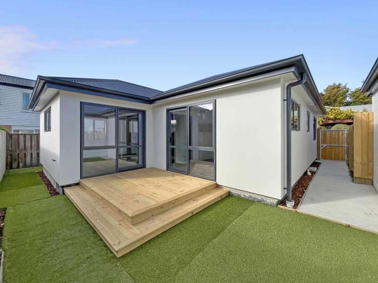
* Living : Open plan dining and lounge with a slider to the patio area
* Bedrooms : Three double bedrooms all with built-in wardrobes
* Bathrooms : Ensuite attached to master and master bathroom both provide a shower, vanity and toilet
* Heating : Double glazed and insulated to the latest standards with a heat pump in the lounge
* Laundry : Located in the garage
* Garage : Single internal access garage
* Storage : Additional hall storage available
* Section:Easy care fully fenced section, with a private deck area
* Pets : Sorry no pets
* Term : Available 17 March for a long term lease
***To book a viewing on this property, please email us to register, or go to https://apply.tenant.co.nz/6495281***
If you do not register, the viewing may not be confirmed. By registering you will be automatically advised of all available viewing times.
For further information please contact Matthew Curtis on 027 466 0364 or Kate Fraser on 021 194 5283.
Payments required to rent will be 2 weeks rent plus 4 weeks bond.
Office hours are Monday - Friday 8:30am - 3:00pm.